Release time:2025-05-19

Product Overview
The intelligent drone-borne hyperspectral automated monitoring system is built around HHIT's self-developed hyperspectral imaging technology and integrates industry-leading UAV platforms and drone hangars. It overcomes key technical challenges in flight control, video transmission, safety monitoring, automated data processing, intelligent alarming, and remote upgrades, significantly lowering the barrier to operation and enabling truly unattended hyperspectral remote sensing monitoring.
The system supports synchronous multi-dimensional data acquisition, capturing 300-band hyperspectral imaging data and high-definition visible-light images in a single flight. Equipped with built-in software algorithms, it automatically calculates common indices such as NDVI and NDWI. Additionally, the system features multi-parameter water quality inversion algorithms, enabling accurate retrieval of key indicators including total nitrogen, total phosphorus, ammonia nitrogen, permanganate index, chlorophyll, and suspended solids—generating clear and intuitive concentration distribution maps for precise traceability.
The system can also be adapted for a wider range of monitoring scenarios through user-customized algorithms.
Application Fields
The intelligent drone-borne hyperspectral automated monitoring system is primarily applied in environmental protection, agricultural and forestry inspection, water quality monitoring, riverway patrol, and other fields, contributing to the development of the national low-altitude economy.
System Advantages
1. Unmanned Autonomous Operation
Through a lightweight hyperspectral payload system integrated with industrial-grade drones and automated drone hangars, the entire remote sensing monitoring system achieves automated mission planning and execution. The drones feature autonomous flight capabilities, support intelligent path planning and dynamic obstacle avoidance, significantly enhancing operational flexibility and safety.
2. Remote Monitoring and Management
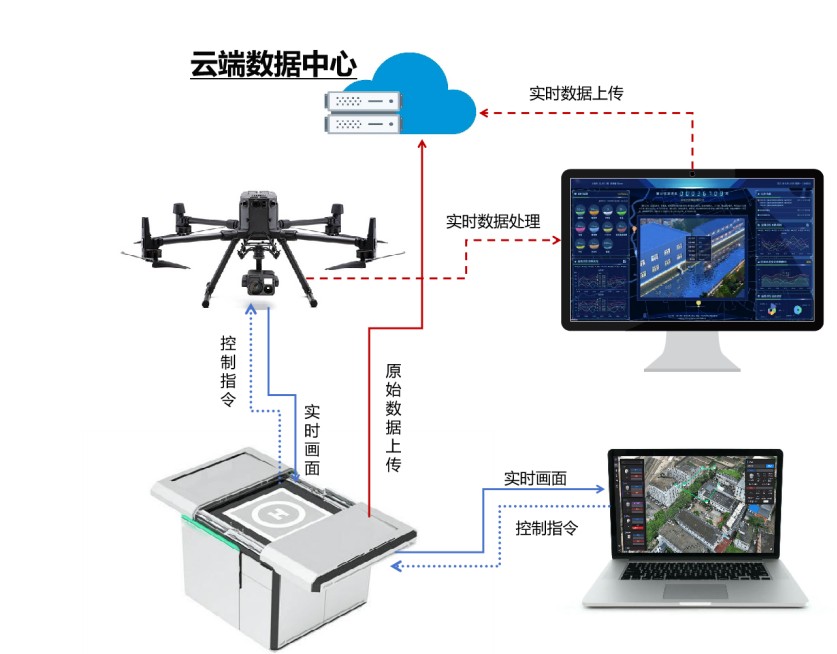
The system provides real-time data feedback at the ground control station, enabling remote monitoring of equipment status, mission progress, and live data streams. Operators can monitor operational status or manually take control during missions to ensure smooth task execution.
3. Built-In Intelligent Algorithms
Equipped with multiple deep learning algorithms, the system allows users to import custom algorithm models based on application needs. It supports independent training and upgrades, continuously expanding application scenarios and improving monitoring accuracy.
4. Real-Time Inversion Capability
Leveraging data acquired in real time by the hyperspectral sensor, the system performs preliminary data processing and inversion, uploading results directly to the cloud platform for instant decision-making support.
5. Adaptability to Multiple Scenarios
With built-in algorithms for water quality monitoring, vegetation indices, and more, a single system supports diverse applications—including agriculture, forestry, water quality management, and urban monitoring—maximizing its utility for low-altitude integrated remote sensing.
6. Third-Party Data Calibration Support
The system can integrate high-precision data from third-party laboratories or online monitoring stations to automatically calibrate airborne remote sensing results, correcting systematic errors and enhancing data accuracy.
System Architecture
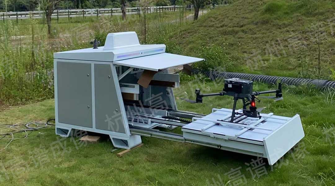
The system is primarily composed of a hyperspectral payload system, an airborne high-definition camera, an unmanned aerial vehicle (UAV), and an automated drone hangar. It supports fully autonomous takeoff, landing, and recharging capabilities.
Additionally, the hangar is equipped with a data server and network infrastructure. Upon the UAV’s return, data is automatically downloaded and processed, with final results uploaded to the user’s server. Real-time data is transmitted directly via the UAV’s communication link to the remote controller and forwarded to the user’s data platform.

Product Specifications
| HY-9010E机巢版无人机载高光谱成像系统 | ||
| 名称 | 指标 | 参数 |
| 高光谱相机 | 光谱范围 | 400-1000nm |
| 光谱分辨率 | 优于3.5nm | |
| 空间通道数 | 1450(1×1) | |
| 光谱通道数 | 921(1×1) | |
| 帧频 | 128fps | |
| 像素 | 500万/1500万 | |
| 可见光相机 | 视场角 | 45-80° |
| 天顶光模块 | 接口 | USB2.0 |
| 光谱范围 | 400-1000nm | |
| GPS定位 | 支持RTK模式 | 定位精度优于10cm |
message
All Rights Reserved@Hangzhou Hyperspectral Imaging Technology Co., Ltd. 浙ICP备19040412号-2 网站地图
Design By: Yushangweb