Industry status


Technical Background
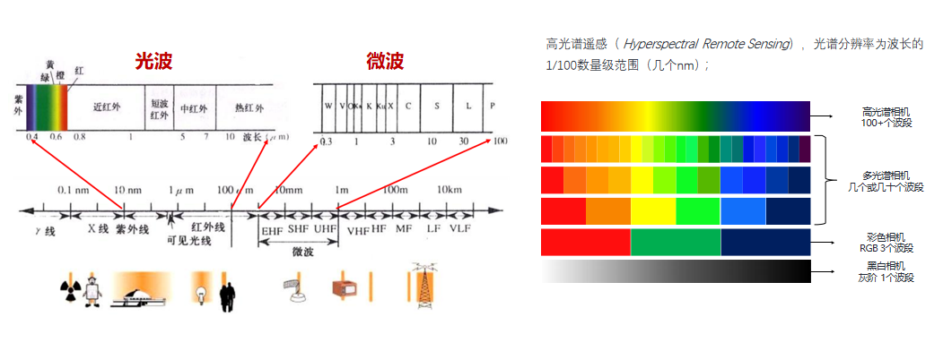
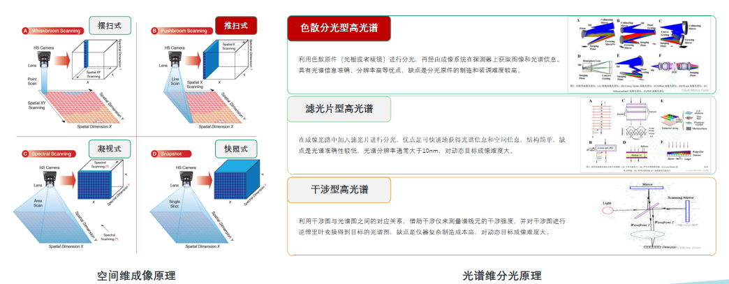
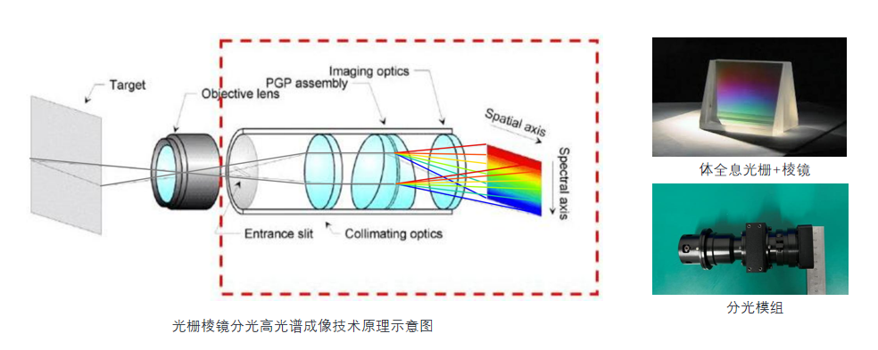
Hyperspectral imaging technology, which came into existence in the early 1980s, is an innovative form of remote sensing. Its core principle lies in the synergistic combination of image morphology and spectroscopy, signaling the future trajectory of modern detection technology development.

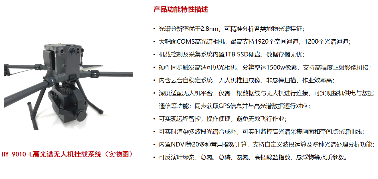
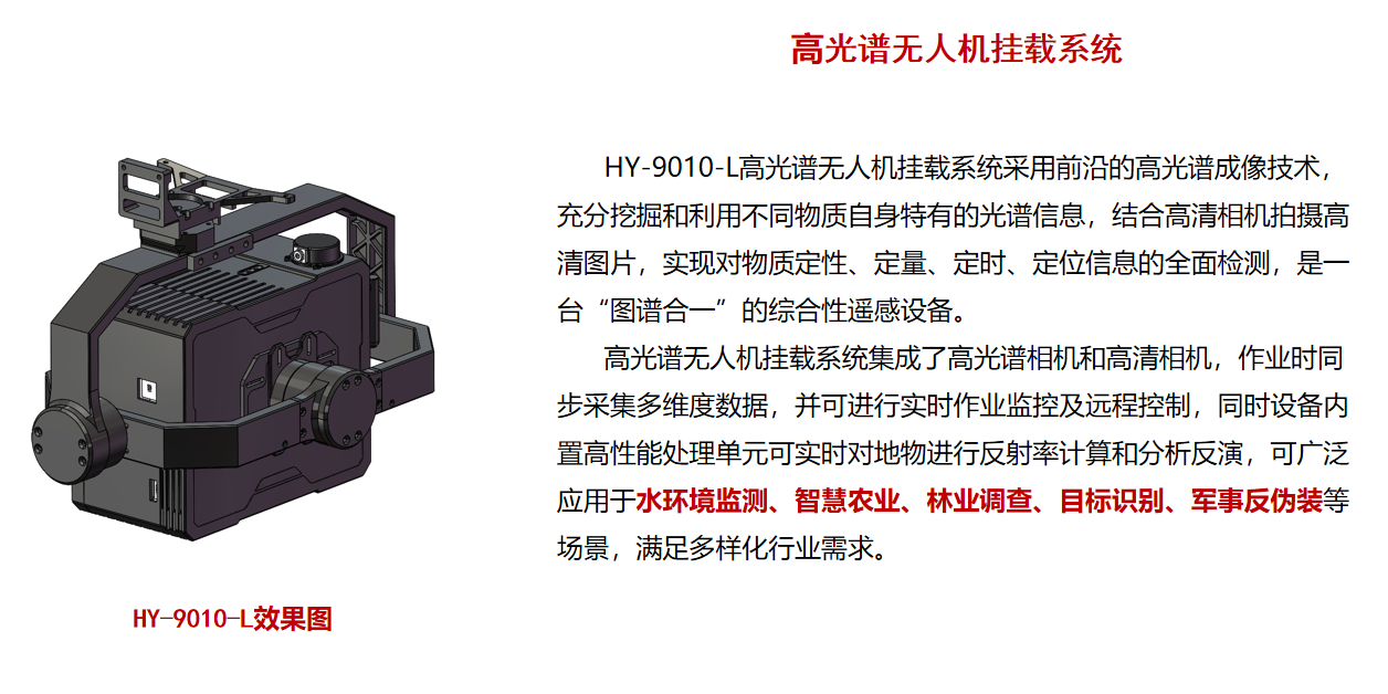
The hyperspectral water quality monitoring solution deployed on UAV platforms constitutes a beneficial supplement to conventional chemical analytical methodologies for water quality assessment. It facilitates the acquisition of a comprehensive grasp of aquatic environmental conditions and their dynamics for users in a prompt, precise, and exhaustive fashion.

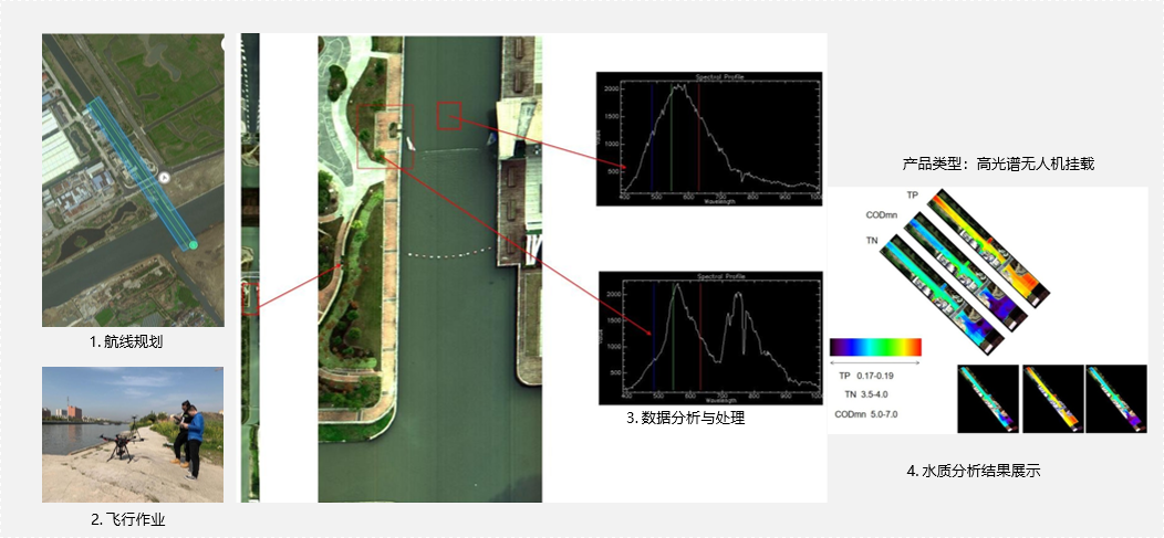
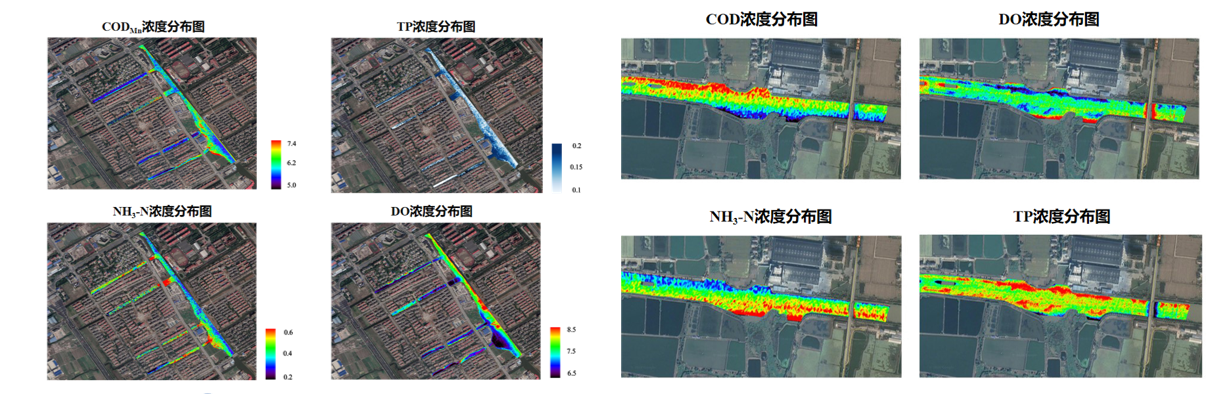
By integrating a hyperspectral imaging system with a UAV platform, remote sensing measurement of a target area is conducted using remote sensing technology along with hyperspectral imaging and analysis. This process yields both images and spectral data of the area. Subsequently, an inversion model is applied to the spectral data to retrieve various water quality parameters, such as Total Nitrogen (TN), Total Phosphorus (TP), and Permanganate Index (CODMn).

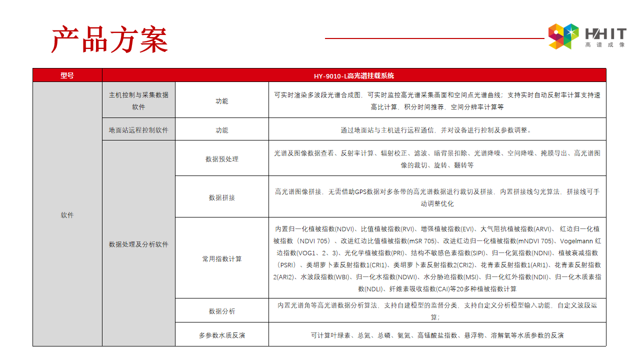
Product solution
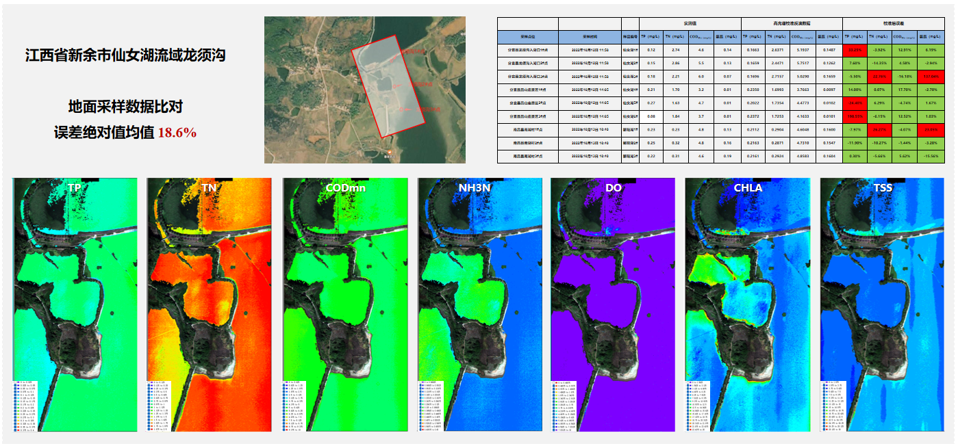
Application Cases
message
All Rights Reserved@Hangzhou Hyperspectral Imaging Technology Co., Ltd. 浙ICP备19040412号-2 网站地图
Design By: Yushangweb