HHIT’s New Nest-Integrated Drone-Borne Hyperspectral System: Ushering in a New Era of Air-Space-Ground Integrated Intelligent Perception
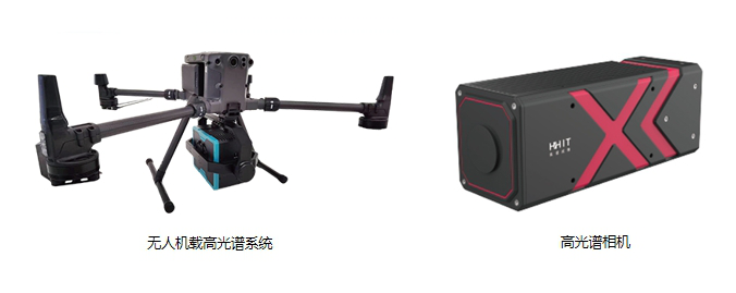
The nest-integrated drone-borne hyperspectral imaging system, a flagship launch by HHIT, is mainly applied in environmental protection, agriculture and forestry inspection, water quality monitoring, river patrol, and other fields, contributing to the development of China’s low-altitude economy industry. Many people may not know what makes this nest-integrated drone-borne hyperspectral system special. Today, we will give you a detailed introduction starting from the hyperspectral camera!
An ordinary camera can only capture images by mixing three basic colors: red, green, and blue. It blends what it "sees" into a single color photo (an RGB image), telling us things like "this looks like green leaves" or "that looks like blue lake water."
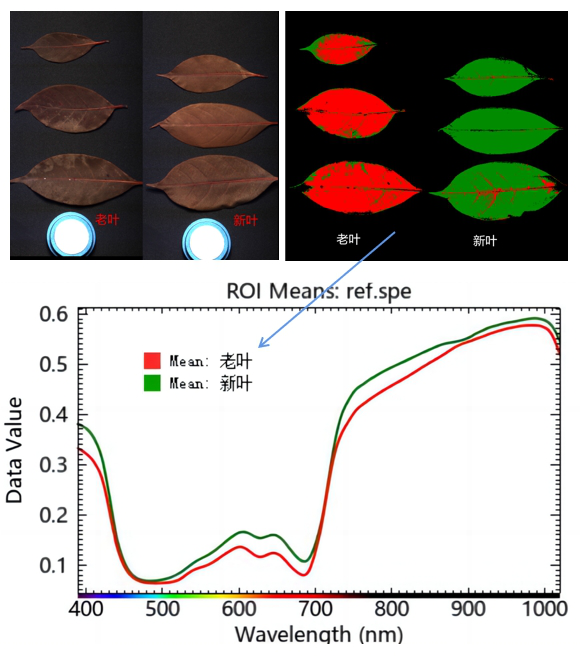
In contrast, a hyperspectral camera can simultaneously "see" hundreds of extremely subtle "colors" (professionally called "spectral bands"). For example, when it comes to green—whether from healthy leaves, water-deficient leaves, or leaves affected by pests and diseases—the reflected spectra have distinct subtle differences! An ordinary camera can only detect a general "green," while a hyperspectral camera can accurately identify these differences. It can not only tell that the leaves are green, but also "determine" whether the leaves have sufficient moisture, whether they are affected by pests or diseases, and even identify the freshness of the leaves!

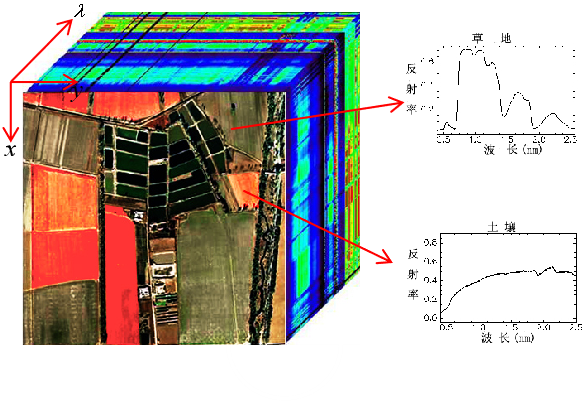
It captures spectral information across over 300 bands in one go, obtaining "spectral cube" data that contains rich chemical composition information—rather than just a single color image. This is the core foundation that enables it to analyze water quality, vegetation health, mineral composition, and more!


A standalone hyperspectral camera can indeed function (e.g., for sample analysis in a laboratory), but the drone-borne hyperspectral imaging system solves several key challenges:
Wide-Range Coverage:
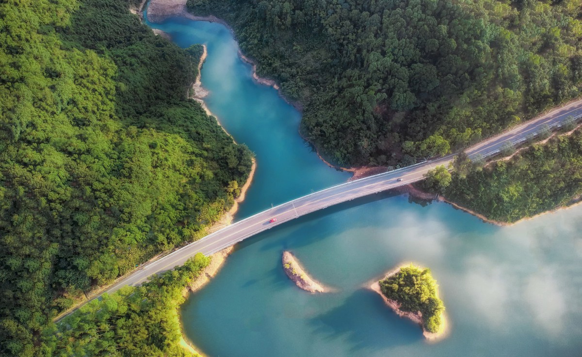
Manual operation of a hyperspectral camera is inefficient and covers only a small area. Drones can quickly fly to high altitudes, efficiently covering large areas such as farmland, rivers, forests, or mining areas. For example, monitoring a river section several kilometers long may take a drone only half an hour to complete— a task that would take a person an entire day to finish on foot.
Access to Hard-to-Reach Areas:
Steep hillsides, dense forests, and the center of vast lakes are difficult for people, vehicles, or boats to access, but drones can reach these locations easily.
Flexible Viewpoints:
Drones can fly at different heights and angles, capturing more comprehensive and flexible data while avoiding obstructions that limit ground-based viewpoints.
Integrated Platform:
A drone is more than just a "flying stand"—it also integrates:
Precision Positioning (GPS/RTK): Ensures each frame of spectral data corresponds to an accurate geographic location (with precision better than 10 cm), which is crucial for map generation.
Stabilized Gimbal: Keeps the camera stable during flight, ensuring clear and non-blurred images.
Flight Control "Brain": Enables automatic flight along a pre-planned route.

This "drone nest" is more than just a "landing pad" — it serves as the "intelligent manager" and "automation engine" of the entire system, representing a qualitative leap compared to regular drone-borne hyperspectral imaging systems:
A regular drone-borne hyperspectral system requires manual work for every flight: moving and assembling the drone, conducting pre-flight checks, manual takeoff, manual monitoring during flight, manual landing, manually removing the data card, manually copying data, and manual recharging… It is time-consuming and labor-intensive! Data processing also demands manually transferring data to another computer and running software for analysis, which takes a long time. Essentially, "humans have to work around the machine," making high-frequency, regular monitoring impossible.
Unmanned Operation: The drone is capable of autonomous flight, with automatic takeoff and landing. It supports intelligent route planning and dynamic obstacle avoidance, significantly enhancing flexibility and safety in practical operations.
Remote Monitoring & Management: The system provides real-time data feedback at the ground station, enabling remote monitoring of equipment operating status, task progress, and real-time data streams. During operations, users can monitor the working status at any time or take manual control if needed, ensuring the smooth execution of tasks.
Built-In Intelligent Algorithms: The system comes with a variety of deep learning algorithms. Users can import different algorithm models based on their application needs, conduct independent training and updates, continuously expanding application scenarios and improving monitoring accuracy.
Real-Time Inversion Capability: Through real-time data acquisition by the hyperspectral sensor, the system can complete preliminary data processing and inversion, and upload inversion results to the cloud platform in real time, providing immediate support for decision-making.
Multi-Scenario Adaptability: The system has built-in algorithms for water quality monitoring, vegetation indices, and more. A single system can support multiple application scenarios such as agriculture, forestry, water quality, and urban areas, maximizing its ability to meet low-altitude comprehensive remote sensing monitoring needs.
Third-Party Data Calibration Support: The system supports accessing high-precision data from third-party laboratories or online monitoring stations to automatically calibrate the airborne remote sensing analysis results, correcting system errors and improving data accuracy.
In simple terms, this system can be described as follows:It equips the drone with a "hyperspectral super eye" that can "see through" the subtle components of objects. It is paired with an "intelligent manager nest" that enables automatic recharging, data downloading, task processing, and autonomous operation of the drone. Additionally, it includes "smart brain software" that converts complex spectral data into useful information such as intuitive water quality maps and vegetation health maps.
The combination of these three components enables fully unmanned, automated monitoring for applications in water quality, agriculture, environmental protection, and other fields! It greatly lowers the threshold for professional remote sensing monitoring, transforming work that previously required significant human and material resources into a fully automated, efficient, and accurate process — elevating monitoring efficiency and continuity to an entirely new level!


